
Autumn Across the Vermont Hills
Photograph ·
Photograph by PaulWMiller · Flickr ↗ · All Rights Reserved
Wilmington & the Deerfield Valley
Vermont
Autumn Guide ↗ put the peak at Mohawk Trail, Hairpin Turn, around . That day has gone, so the newest pictures below are the truer guide to what is left on the trees.
Photographs of Somerset town area and the country around it, anywhere within 25 miles of Somerset town area, newest first. Each is shown with the day it was taken.
Photograph ·
Photograph by PaulWMiller · Flickr ↗ · All Rights Reserved
Wilmington & the Deerfield Valley
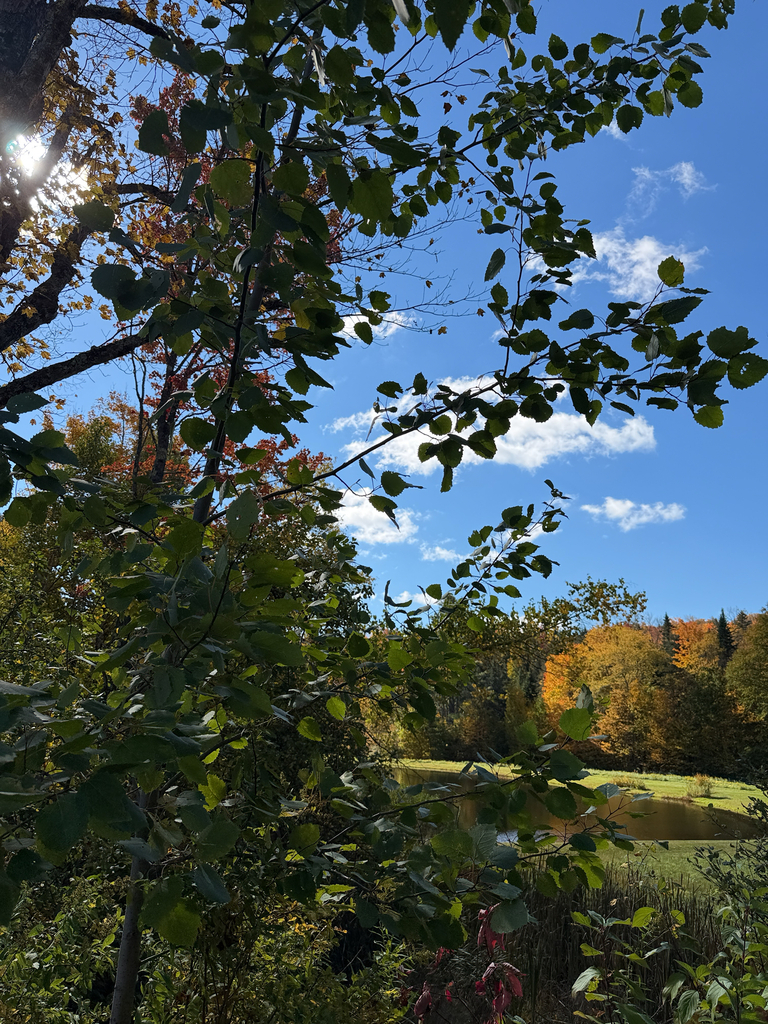
Photograph ·
Photograph by harrietd428 · iNaturalist ↗ · CC BY-NC 4.0 ↗
Londonderry, Vermont
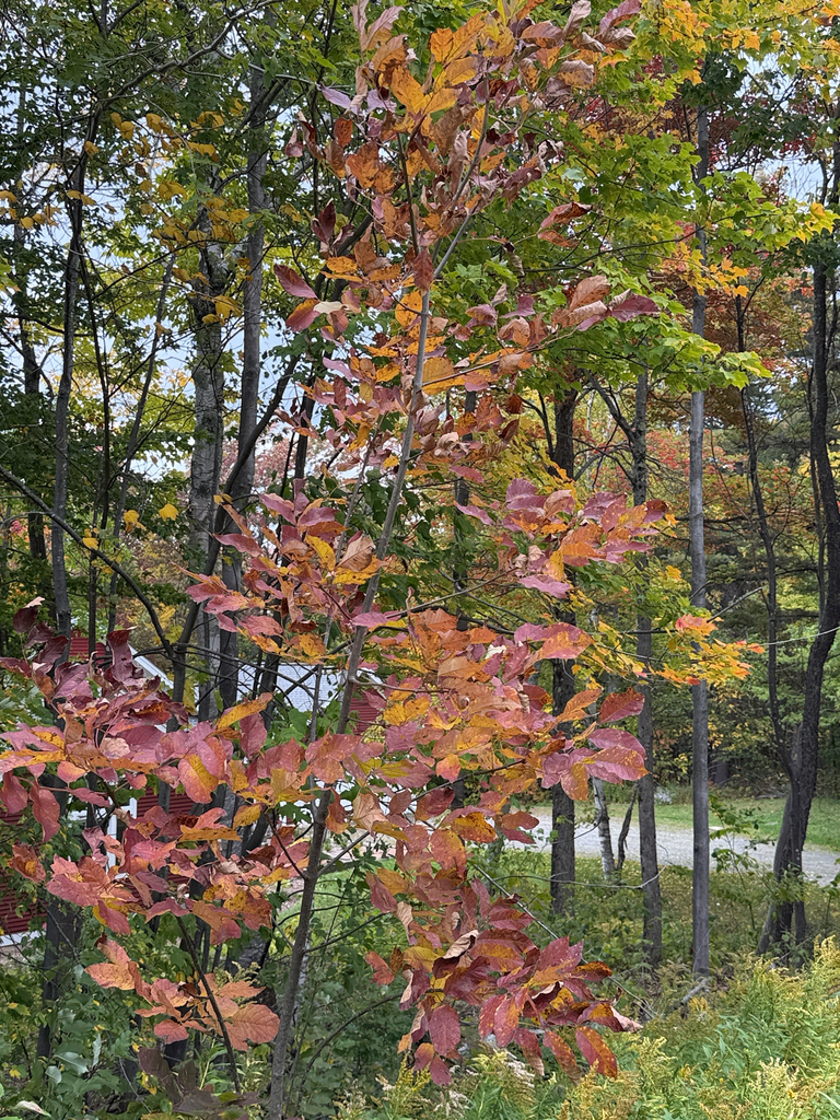
Photograph ·
Photograph by harrietd428 · iNaturalist ↗ · CC BY-NC 4.0 ↗
Bondville, Vermont

Photograph ·
Photograph by Putneypics · Flickr ↗ · CC BY-NC 4.0 ↗
West River Trail, Brattleboro, Vermont

Photograph ·
Photograph by Gary/-King · Flickr ↗ · All Rights Reserved
West River, South Londonderry, Vermont
Taken between early September and late November in earlier years, these show how the season runs here.

Photograph ·
Photograph by Putneypics · Flickr ↗ · CC BY-NC 4.0 ↗
West River Trail, Brattleboro, Vermont

Photograph ·
Photograph by Paul-W · Flickr ↗ · CC BY-NC-SA 4.0 ↗
Freedley Quarry trail, Dorset, Vermont

Photograph ·
Photograph by Paul-W · Flickr ↗ · CC BY-NC-SA 4.0 ↗
Freedley Quarry trail, Dorset, Vermont

Photograph ·
Photograph by Paul-W · Flickr ↗ · CC BY-NC-SA 4.0 ↗
Freedley Quarry trail, Dorset, Vermont

Photograph ·
Photograph by jlucierphoto · Flickr ↗ · All Rights Reserved
West Arlington covered bridge and church, Arlington, Vermont

Photograph ·
Photograph by Professor Bop · Flickr ↗ · All Rights Reserved
Ward's Cove, Harriman Reservoir, Wilmington, Vermont

Photograph ·
Photograph by TheGreatWiseAss · Flickr ↗ · All Rights Reserved
Monastery Overlook, Mount Equinox, Manchester, Vermont

Photograph ·
Photograph by tjohn611 · Flickr ↗ · All Rights Reserved
West River behind the mill, Weston, Vermont

Photograph ·
Photograph by MIKECNY · Flickr ↗ · All Rights Reserved
Battenkill River, West Arlington, Vermont

Photograph ·
Photograph by Famartin · Wikimedia Commons ↗ · CC BY-SA 4.0 ↗
Route 2 below Petersburgh Pass, Williamstown

Photograph ·
Photograph by 72Prep · Flickr ↗ · All Rights Reserved
Skyline Drive, Mount Equinox, Arlington and Manchester, Vermont

Photograph ·
Photograph by - Ozymandias - · Flickr ↗ · All Rights Reserved
Williamstown, Massachusetts

Photograph ·
Photograph by - Ozymandias - · Flickr ↗ · All Rights Reserved
Williamstown, Massachusetts, below the Greylock range

Photograph ·
Photograph by Eridony · Flickr ↗ · All Rights Reserved
Mohawk Trail overlook above North Adams, Massachusetts
,_September_2022.jpg)
Photograph ·
Photograph by Pi.1415926535 · Wikimedia Commons ↗ · CC BY-SA 4.0 ↗
Top o' the World, Hoosac Range, over North Adams

Photograph ·
Photograph by MarcBogonovich · Wikimedia Commons ↗ · CC BY-SA 4.0 ↗
Mount Aeolus, Dorset, Vermont

Photograph ·
Photograph by MarcBogonovich · Wikimedia Commons ↗ · CC BY-SA 4.0 ↗
Prentiss Pond, Dorset, Vermont

Photograph ·
Photograph by MarcBogonovich · Wikimedia Commons ↗ · CC BY-SA 4.0 ↗
Prentiss Pond, Dorset, Vermont

Photograph ·
Photograph by Famartin · Wikimedia Commons ↗ · CC BY-SA 4.0 ↗
Warm Brook, East Arlington

Photograph ·
Photograph by Famartin · Wikimedia Commons ↗ · CC BY-SA 4.0 ↗
Saint Bruno Scenic Viewing Area, Mount Equinox

Photograph ·
Photograph by Famartin · Wikimedia Commons ↗ · CC BY-SA 4.0 ↗
Mount Equinox, about 3,350 feet
_at_Muddy_Lane_in_Manchester,_Bennington_County,_Vermont.jpg)
Photograph ·
Photograph by Famartin · Wikimedia Commons ↗ · CC BY-SA 4.0 ↗
Historic Vermont Route 7A
.jpg)
Photograph ·
Photograph by Ethan Long · Wikimedia Commons ↗ · CC BY-SA 2.0 ↗
North Shire Lodge, Manchester, Vermont
.jpg)
Photograph ·
Photograph by ~jar{} from Berkeley, California · Wikimedia Commons ↗ · CC BY 2.0 ↗
Woodcock Road, Williamstown

Photograph ·
Photograph by -jkb- · Wikimedia Commons ↗ · CC BY-SA 3.0 ↗
Mohawk Trail, east end
The captioned photographs identify towns, not exact viewpoints.