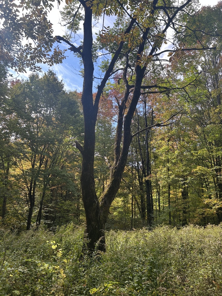
Woods just starting to turn, Moosalamoo
Photograph ·
Photograph by jbutnor · iNaturalist ↗ · CC BY-NC 4.0 ↗
Salisbury, Vermont
Vermont
Autumn Guide ↗ put the peak at Appalachian Gap, Vermont Route 17, around . That day has gone, so the newest pictures below are the truer guide to what is left on the trees.
Photographs of Middlebury Gap & Snow Bowl and the country around it, anywhere within 25 miles of Middlebury Gap & Snow Bowl, newest first, with a link to a camera’s page. Each is shown with the day it was taken.
Photograph ·
Photograph by jbutnor · iNaturalist ↗ · CC BY-NC 4.0 ↗
Salisbury, Vermont

Photograph ·
Photograph by InnAtElmwood · Flickr ↗ · All Rights Reserved
Near Pittsfield, Vermont

Photograph ·
Photograph by psu13 · Flickr ↗ · All Rights Reserved
Killington, Vermont

Photograph ·
Photograph by devtmefl · Flickr ↗ · All Rights Reserved
Bridgewater Corners, Vermont

Photograph ·
Photograph by R. Braley · Flickr ↗ · All Rights Reserved
Waitsfield, Vermont

Photograph ·
Photograph by Marv and Sue Elliott · Flickr ↗ · All Rights Reserved
Lefferts Pond, Chittenden, Vermont

Photograph ·
Photograph by Marv and Sue Elliott · Flickr ↗ · All Rights Reserved
Chittenden Reservoir, Chittenden, Vermont
The player connects to YouTube when you open it. Check its picture and clock before planning a visit.
Taken between early September and early November in earlier years, these show how the season runs here.

Photograph ·
Photograph by Symbiosis · Flickr ↗ · All Rights Reserved
Chittenden Reservoir, Chittenden, Vermont

Photograph ·
Photograph by Symbiosis · Flickr ↗ · All Rights Reserved
Chittenden Reservoir, Chittenden, Vermont

Photograph ·
Photograph by Marv and Sue Elliott · Flickr ↗ · All Rights Reserved
Kent Pond, Killington, Vermont

Photograph ·
Photograph by Marv and Sue Elliott · Flickr ↗ · All Rights Reserved
Kent Pond, Killington, Vermont

Photograph ·
Photograph by InnAtElmwood · Flickr ↗ · All Rights Reserved
Chittenden Reservoir, Chittenden, Vermont

Photograph ·
Photograph by Marv and Sue Elliott · Flickr ↗ · All Rights Reserved
Kent Pond, Killington, Vermont

Photograph ·
Photograph by tjohn611 · Flickr ↗ · All Rights Reserved
Bridgewater, Vermont (a farm road)

Photograph ·
Photograph by tjohn611 · Flickr ↗ · All Rights Reserved
Common Road, Waitsfield, Vermont

Photograph ·
Photograph by tjohn611 · Flickr ↗ · All Rights Reserved
Kent Pond, Killington, Vermont

Photograph ·
Photograph by DaveWilsonPhotography · Flickr ↗ · All Rights Reserved
Mountain Valley Farm, near Irasville, Waitsfield, Vermont

Photograph ·
Photograph by DaveWilsonPhotography · Flickr ↗ · All Rights Reserved
Near Waitsfield, Vermont (a sugar shack)

Photograph ·
Photograph by rhayward46 · Flickr ↗ · All Rights Reserved
Warren, Vermont (a mountain brook)

Photograph ·
Photograph by rhayward46 · Flickr ↗ · All Rights Reserved
Waitsfield, Vermont (a steel bridge on a back road)

Photograph ·
Photograph by tjohn611 · Flickr ↗ · All Rights Reserved
Bridgewater, Vermont

Photograph ·
Photograph by 72grande · Flickr ↗ · All Rights Reserved
Route 12, Barnard, Vermont
_1.jpg)
Photograph ·
Photograph by James St. John · Wikimedia Commons ↗ · CC BY 2.0 ↗
Appalachian Gap, Vermont Route 17
The mountain camera and the road through Middlebury Gap offer an area reference. Woodland at lower elevations can change at a different pace.