
Great Smoky Mountains
Photograph ·
Photograph by kingdufus · Flickr ↗ · All Rights Reserved
12 miles from here
North Carolina
Autumn Guide’s forecast ↗ expects the peak at Biltmore Estate around . Slopes above or below that spot may turn earlier or later.
As of , the newest picture is from the camera at French Broad River near Bent Creek, 17 miles from here, taken (1 day earlier). The newest nearby photograph is from (4 days earlier), 12 miles from here.
The nearest camera, French Broad River near Bent Creek, 17 miles from here: its three pictures from the past 7 days, newest first.
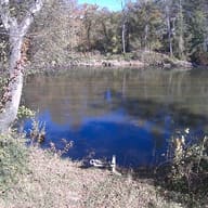
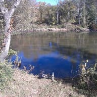
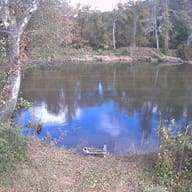
No photograph from here has been posted this fall.
Photographs from within 25 miles of here, newest first, then camera links.
Photograph ·
Photograph by kingdufus · Flickr ↗ · All Rights Reserved
12 miles from here
Check the park or tourism source for access and closures before travel; this entry does not report current color; the links below open the cameras’ pages.
From Mount Mitchell, a view to the north-northwest.
North Carolina High Peaks Trail Association · Mount Mitchell, North Carolina
Read the time named above the picture before trusting it, and reload the page for a newer one; at night the picture is dark.
From Mount Mitchell the camera looks north-northeast to Mount Craig and Big Tom.
North Carolina High Peaks Trail Association · Mount Mitchell, North Carolina
Read the time named above the picture before trusting it, and reload the page for a newer one; at night the picture is dark.
From the summit of Mount Mitchell, a view to the northeast.
North Carolina High Peaks Trail Association · Mount Mitchell, North Carolina
Read the time named above the picture before trusting it, and reload the page for a newer one; at night the picture is dark.
From Mount Mitchell the camera looks southeast toward Green Knob.
North Carolina High Peaks Trail Association · Mount Mitchell, North Carolina
Read the time named above the picture before trusting it, and reload the page for a newer one; at night the picture is dark.
From the park office at Stepps Gap, below the summit, a view to the west.
North Carolina High Peaks Trail Association · Mount Mitchell, North Carolina
Read the time named above the picture before trusting it, and reload the page for a newer one; at night the picture is dark.
From near Seven Mile Ridge in Yancey County, a view southwest to the east side of the Black Mountains.
North Carolina High Peaks Trail Association · Mount Mitchell, North Carolina
Read the time named above the picture before trusting it, and reload the page for a newer one; at night the picture is dark.
From the south side of Blue Knob, a view southeast to Mount Mitchell and the west side of the Black Mountains.
North Carolina High Peaks Trail Association · Mount Mitchell, North Carolina
Read the time named above the picture before trusting it, and reload the page for a newer one; at night the picture is dark.
A camera at the base of Hatley Pointe's slopes and lodge, in the mountains near Mars Hill.
ResortCams · Mars Hill, North Carolina
Start the player and read the camera's clock, if it shows one, before trusting the picture: a stream that has stopped can leave an old picture on the screen.
This camera is within 25 miles of Blue Ridge Parkway at Craggy Gardens. This site collects its picture every morning; follow it day by day on the Cameras page.
Check the park or tourism source for access and closures before travel; this entry does not report current color.